-
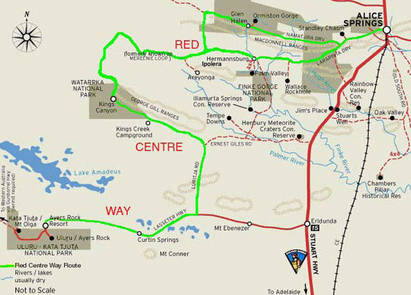
Map of the Mereenie Loop and the Outer Mereenie Loop on The Red Centre Way from Alice Springs Northern Territory Australia
The Mereenie Loop starts Glen Helen Homestead and goes 145 klm to Kings Canyon Resort.
Mereenie Loop Update 28.06.2017: I just rang Glen helen Homestead and was told the 145 klm road from Glen Helen to Kings Canyon part of the Mereenie Loop is still not sealed and is a dirt road still. Other areas upgrades have been made appartently.
Update 06/04/2017: www.aliceSpringsnews.com.au/
The opening of the all-bitumen Inner Mereenie Loop Content Alice Springs News: The government has not sealed the mere six kilometers from the loop road to Gosse�s Bluff / Tnorala (at top, and below), limiting the track to 4WD, and shutting out anyone in a 2WD as well as anyone towing a caravan, the categories dominant in the vehicles we saw on the loop, from one of the pearls in our tourism crown, and one of the reasons for completing the loop seal. So the outer Mereenie Loop the one we use in the 4wd industry is still unsealed. best to check with the Alice Springs Vistor information Centre when you wish to go.
Travel guide on Alice Springs in Northern Territory Australia
Map of Alice Springs
Map of West MacDonnell Ranges
Map of East MacDonnell Ranges
All about the MacDonnell Ranges (Trusted old website locally compiled)
Alice Springs 4wd camper hire
Alice Springs motorhome rental
Alice Springs airport car hire (external link to Airport Rentals) -

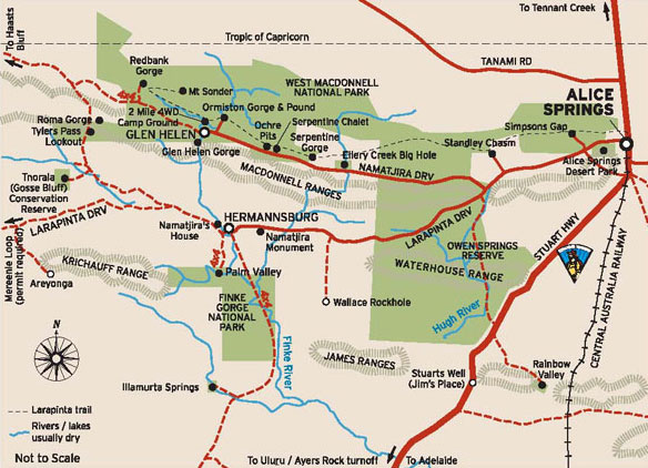
Map of Australia's Mereenie Loop on the Red Centre Way from Alice Springs
West MacDonnell Ranges tourist selfdrive tourist hire guide
The East and West MacDonnell Ranges stretch out for hundreds of kilometres on both sides of Alice Springs. The traditional owners of the Alice Springs area, the Arrernte people, believe giant caterpillars called the Yeperenye became the Ranges - they entered this world through one of the dramatic gaps in the escarpments of the area.
See our map above for the Mereenie Loop on the Red Centre Way from Alice Springs
West MacDonnell National Park | West MacDonnell National Park is a vast and spectacular section of the MacDonnell Ranges and an outstanding example of an ancient landscape sculptured over time by climatic elements. The West MacDonnell (Tyurretye) National Park stretches some 161 km due west of Alice Springs. There are cool scenic gorges being mportant refuges for plants and animals, many of which are found only here and some are relicts of a bygone era of tropical forests such as Palm Valley.
West MacDonnell National Park access | is accessible nearly all year round. The cooler months (April to September) are the most pleasant. All roads can be impassible for short periods after heavy rain.
-

Australia 4 Wheel Drive RentalsOur senses of sight and sound are flooded every day by film and TV. Though if you take a real holiday especially along the coast or the great Australian outback then your other senses of smell and touch will come alive as well. Let a Darwin sunset on Mindil Beach warm up your senses to smelling the pristine outback wilderness of the remote outback Kimberley. When you travel in Australia folks don't just gaze but look and you will see amazing Australian flora and fauna. If you're a family, couple or friends you will create memories most likely from the small things that you experience on the trip such as a butterfly sitting on your cup of tea whilst you're at a roadside stop on the Banks of the Ord River.
We see and hear every day travel is a experience actually it's an achievement - like to catch sunset at very minute the sun touch the oceans horizon from the viewing points along the Great Ocean Road.
Plan your holiday so you travel like never before and interact with fellow like minded adventure travellers, the locals and their cultures.
Catch a fish then both of you take a selfie and give your finned friend a new lease on life and throw it back.
Taste real fusion Aussie/Asian cuisine or just great fish and chips the Aussie way.
If Marg and Rob have to have a motto then it would be 'plan well, travel at your own leisure and enjoy the little things Australia has to offer you'.
Get a instant quote now | email us | fill in a quote request | call us
-

Australia 4 Wheel Drive RentalsAustralian 4 Wheel Drive Rentals your one stop shop for 4wd - 4x4 campers, cars and wagons, 4wd's with tent gear, 4wd's with rooftop tents and side ground annexe | 4wd's and sleep internally.
Australian 4 Wheel Drive Rentals major suppliers also ave a large range of budget campervans to modern well appointed spacious automatic motorhomes from all states and territories.
Get a instant quote now or email us or fill in a quote request
-
 4wd Campersn
Gibb, Birdsville, Oodnadatta
4wd's for remote tracks -
 4wd Wagons
4wd cars to go on unsealed roads
4wd car rental -
 Camper 2ST
2 Berth toilet | shower | kitchen
Campervan hire -
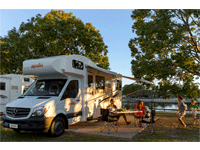 Motorhomes
2-6 Berth toilet | shower | kitchen
Motorhome rentals -
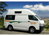 Camper Hitops
2 to 4 Berth budget campervans
Campervan hire -
 Worldwide
Car - airport, town and city
Car hire Australia -

Key tourism destinations for 2wd driving in AustraliaBest places to start these key Australian Destinations are
Melbourne along The Great Ocean Road to Adelaide or to Alice Springs
Sydney one way to Cairns, Brisbane, Adelaide, or Melbourne
Perth loop trip or to Broome then onto Darwin
Yes you can see the inner wilderness and coastline in a 2wd motorhome rental even if you have to keep to the sealed roads. A lot of major suppliers we book allow you can travel on a unsealed road up to 12 Klm to a commercial campground and major tourist attractions.
Best time to travel in Australia
Safety tips on driving along Australian roads
Recommended camper and motorhome supplies
Get a instant quote now | email us | fill in a quote request | call us
-
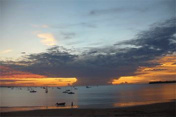 Start 4wd hire or campervan rental from Darwin
Start from Darwin Australia travel loop or one way plan
Start Darwin -
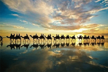 Start 4wd hire or campervan rental from Broome
Start from Broome and go one way to Perth or Darwin
Start Broome -
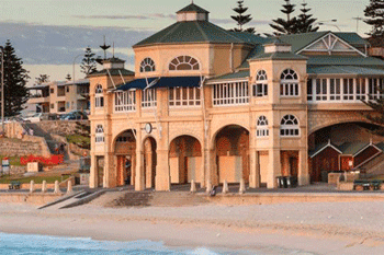 Start from your camper hire or 4wd rental from Perth
Start Perth do loop or one way to Broome or Adelaide
Start Perth -
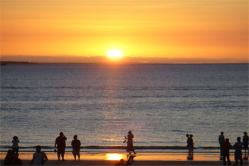 Start from your 4wd camper hire from Alice Springs
Our campers or motorhome are only from Alice Springs
Start Alice Springs -
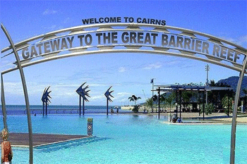 Start from your camper hire or 4wd rentals from Cairns
Start from Cairns and travel south along the East Coast
Start Cairns -


Key tourism destinations for 2wd sealed road driving in AustraliaTravel Plan your next yearly holiday or vacation and start from Sydney, Melbourne, Hobart, Adelaide, Sydney or Brisbane and even Cairns. Travel one way in a self drive motorhome rentals across Australia at your own leisure and comfort. Cook what you want, stop when you want, even for that birding photo that you have to wait 20 minutes to snap. It's you holiday so if you don't want to part of a guide on a tight schedule and guided then the option is a motorhome hire and where else to search but here at Australia 4 Wheel Drive Rentals. Sure our name says 4wd rental hire but honestly we established so long ago and have built up a trusted brand we figured why change it.
Get a instant quote now | email us | fill in a quote request | call us

-
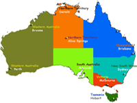 100's of links
 -
 Around Australia
 -
 What to bring
 -
 Xmas Specials
 -
 Convoy's
 -
 Eco Policy
 -
 3 Month Special
 -
 Weather
 -
 What to expect
 -
 Confused Uluru
 -
 Safari Camps
 -
 The Kimberley
 -
 Uluru Ayers Rock
 -
 Kata Tjuta
 -
 Katherine Gorge
 -
 Arnhem Land
 -
 Devils Marbles
 -


AUSTRALIA 4 WHEEL DRIVE RENTALS GPO Box 3410, Darwin AustraliaAustralia 4 Wheel Drive Rentals
Australian Business No. 54 561 356 425
Australia 4 Wheel Drive Rentals Group - 48 Cavenagh Street Darwin, GPO Box 3410, Darwin Australia
Website: https://www.australia4wheeldriverentals.com/
Telephone International: +61 8 7999 7511
Telephone within Australia Toll free: 1800 107 371
Telephone within Australia: 08 7999 7511
Email: [email protected]
Office Hours: Mon-Fri 9am-7pm EST | Sat-Sun and Public Holidays 11am-3pm
Online and internet based specialists.
Hotel real time Availability
![]() read more
read more
Hotel Bookings - Wotif is Australia�s favourite online travel
destination. Wotif started in the early dotcom days in 2000. Today it's
one of Australia's most recognised brands for online travel agents.
Great rates, wide range, easy-to-use site is popular for Australians
to book their travel plans online.
